Satellite Internet for Maritime and Offshore Vessels: A Complete Guide
By GCCSAT Editorial Team • April 29, 2026 • 8 min read
The sea has always been one of the hardest places on earth to stay connected. For most of maritime history, that was simply accepted — you sailed out of port, and you were on your own until you returned. But the modern maritime industry doesn't work that way anymore, and hasn't for a long time.
A tanker crossing the Arabian Sea is simultaneously managing cargo monitoring systems, communicating with the charterer, receiving updated weather routing from a shore-based service, processing ECDIS chart corrections, logging AIS data, maintaining GMDSS compliance, and providing the crew with enough internet access to keep morale from cratering on a three-week passage. A fishing vessel in the Indian Ocean needs VMS (Vessel Monitoring System) connectivity for regulatory compliance, weather data for safety, and catch pricing information to make smart decisions about where to land. An offshore supply vessel servicing a platform in the Persian Gulf needs the same operational connectivity as the platform itself.
Satellite internet is the only technology that can meet these needs across all of these vessel types and all of these ocean areas. The question is which satellite technology — and increasingly, which combination — is right for your operation.
Understanding the Maritime Connectivity Requirement
Before comparing technologies, it's worth being specific about what maritime connectivity actually needs to deliver. The requirements vary significantly by vessel type, but the categories of demand are consistent.
Operational Communications
This is the non-negotiable baseline. Vessel-shore communications, cargo tracking, charter party communications, port authority notifications, weather routing services, navigational safety services. These don't require high bandwidth but they require high reliability and availability. A brief outage during normal cruising is inconvenient. A brief outage during a weather emergency is potentially catastrophic.
Regulatory and Safety Systems
GMDSS (Global Maritime Distress and Safety System) requirements mandate specific communication capabilities for vessels operating offshore. VMS requirements for fishing vessels are increasingly stringent — many flag states and RFMOs (Regional Fisheries Management Organisations) require continuous, tamper-evident position reporting with short reporting intervals. Failure to maintain VMS connectivity can result in fishing licence suspension.
Remote Diagnostics and Technical Support
Modern vessels are sophisticated machines. Engine management systems, propulsion control, cargo handling systems, and navigation equipment all generate diagnostic data that shore-based technical teams need to monitor. Remote access for troubleshooting avoids expensive unscheduled port calls. This traffic is moderate bandwidth but sensitive to reliability — a remote diagnostic session that drops mid-stream is worse than useless.
Crew Welfare
The maritime industry has a persistent seafarer welfare problem. Long passages, isolation from family, and the physical and psychological demands of life at sea contribute to high turnover rates and recruitment difficulties. The International Maritime Organisation and the Maritime Labour Convention increasingly recognise internet access as a welfare necessity rather than a luxury. Practically, a fleet operator who provides reliable crew internet has a genuine competitive advantage in crew recruitment and retention.
Crew internet demands can be substantial. On a vessel with 20 crew, evening internet access peaks might involve simultaneous video calls, streaming, and social media from most of the off-watch complement — easily 50–100 Mbps of aggregate demand.
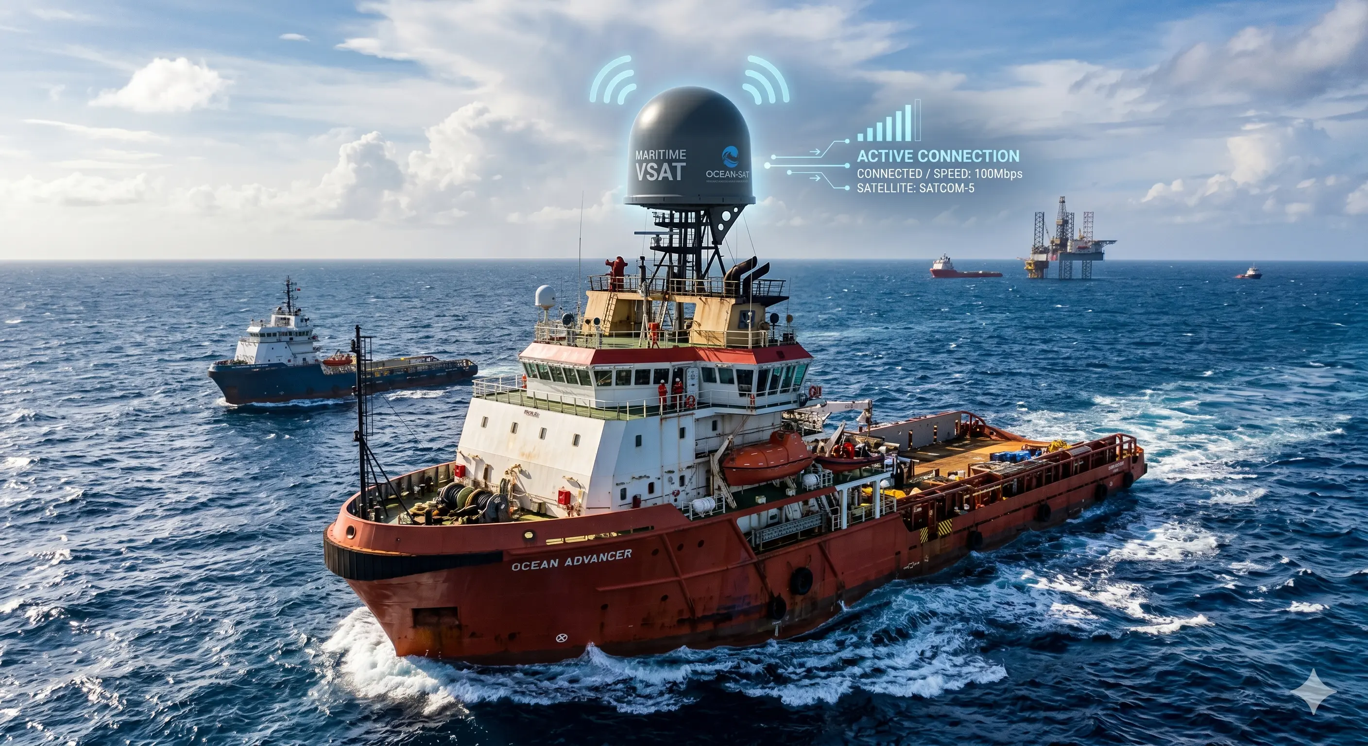
VSAT Maritime: The Traditional Backbone
Traditional maritime VSAT — primarily Ku-band, with Ka-band and C-band in specific applications — has been the maritime industry's connectivity backbone for two decades. The technology is mature, well-understood, and supported by a global ecosystem of maritime VSAT providers, terminal manufacturers, and installation specialists.
Ku-Band Maritime VSAT
Ku-band VSAT (11–14 GHz) remains the most widely deployed maritime satellite technology globally. The key reason is coverage: Ku-band satellites provide near-global ocean coverage between approximately 75°N and 75°S latitude, covering all major shipping lanes, fishing grounds, and offshore oil and gas areas in MENA, Africa, and Europe.
Typical maritime Ku-band performance:
- Download throughput: 2–20 Mbps on shared VSAT plans, up to 64 Mbps on dedicated links
- Upload throughput: 0.5–5 Mbps typical
- Latency: 600–700 ms round-trip (GEO)
- Antenna size: 0.9m–1.8m stabilised gyroscopic antenna
- Rain fade sensitivity: Moderate — well-manageable with proper link budget design
The stabilised antenna — which maintains dish pointing accuracy as the vessel pitches, rolls, and yaws — is one of the distinctive challenges of maritime VSAT installation. Quality maritime Ku-band systems from manufacturers like Intellian, KVH, and Cobham use 3-axis stabilised mounts that maintain pointing accuracy to within fractions of a degree in sea states up to Beaufort 6–7.
Ka-Band Maritime VSAT
Ka-band maritime VSAT offers significantly higher throughput than Ku-band at lower cost per megabit, leveraging HTS (High Throughput Satellite) capacity. Inmarsat's Fleet Xpress service (combining GX Ka-band and L-band backup) and similar services from other operators deliver 50–100+ Mbps to maritime terminals at price points that have changed the economics of maritime connectivity.
Ka-band maritime terminals are also physically smaller and lighter than their Ku-band equivalents for the same throughput, which matters for smaller vessels where topside space and weight are constrained.
The trade-off is rain fade sensitivity — Ka-band is more affected by heavy precipitation than Ku-band. In practice, modern Ka-band maritime systems include Adaptive Coding and Modulation (ACM) that degrades gracefully through weather events rather than dropping the link entirely. For the vast majority of ocean areas in MENA, the Mediterranean, and temperate European waters, Ka-band availability is excellent.
Starlink Maritime: The Disruptive New Player
Starlink Maritime has disrupted the maritime VSAT market faster than most established operators anticipated. The combination of high throughput, low latency, and dramatically lower cost has convinced a significant number of maritime operators to either switch from VSAT or add Starlink as a primary link.
The Starlink Maritime product (distinct from the residential Starlink service) is purpose-designed for vessel use:
- Terminal: IP67 weatherproof flat panel antenna, no moving parts, designed for marine environment
- Coverage: Approximately 70°N to 70°S, covering most commercial shipping lanes
- Download throughput: 100–220 Mbps typical
- Upload throughput: 20–40 Mbps typical
- Latency: 20–60 ms — dramatically lower than VSAT
- Cost: Starlink Maritime Business pricing starts around $1,000/month (plus hardware) — significantly below comparable VSAT bandwidth
The no-moving-parts flat panel design is genuinely innovative for maritime applications. Traditional maritime VSAT antennas are mechanically complex — their stabilised mounts require maintenance and can fail. The Starlink flat panel has no gyroscopic or mechanical pointing elements. It uses electronically steered phased array technology to track satellites across the sky. Mechanically simpler means fewer failure modes.
The caveats are real, though. Starlink Maritime performs best in regions where the constellation has dense coverage — the North Sea, Mediterranean, and major ocean routes are well-served. Some areas of the Arabian Sea and Indian Ocean have thinner coverage. The service has fewer formal SLA commitments than enterprise VSAT contracts. And because the flat panel has a fixed field of view, large superstructures can cause blocking issues that a traditional steerable dish can work around.
OneWeb Maritime: Polar Coverage and Enterprise Positioning
OneWeb's maritime product occupies a distinct niche. Operating at 1,200 km altitude (higher than Starlink), OneWeb achieves genuine polar coverage to approximately 90° — making it the only LEO constellation with commercial maritime service above 70° latitude, where Starlink's coverage becomes marginal.
This matters for Arctic shipping, which is growing as northern sea routes become commercially viable. Norwegian, Russian, and Canadian Arctic operators, as well as Antarctic research vessels, have OneWeb as essentially the only LEO option.
OneWeb's maritime service is sold through service partners (GCCSAT is an authorised OneWeb reseller) with enterprise-grade SLAs and support structures more similar to traditional VSAT than to Starlink's consumer-oriented service model. Throughput is typically 50–150 Mbps download, 10–30 Mbps upload, with 30–80 ms latency.
For MENA and African maritime operators, OneWeb's growing coverage in those regions — particularly across the Arabian Sea, Persian Gulf, Red Sea, and East/West African coastal waters — is increasingly compelling. See our OneWeb solutions page for current coverage information.
Hybrid Maritime Architectures: Getting the Best of Both
The most effective maritime connectivity approach for vessels with meaningful operational and crew welfare demands combines VSAT and LEO satellite via an SD-WAN platform. This isn't just marketing — it's what the physics and operational requirements dictate.
A practical hybrid maritime architecture for a mid-sized commercial vessel might look like this:
- Primary link: Starlink Maritime — handles crew welfare traffic, remote expert access, and high-bandwidth operational applications. Preferred for its low latency and high throughput.
- Secondary/backup link: Ku-band VSAT — handles critical GMDSS-adjacent communications, VMS, SCADA/engine monitoring, and provides always-on fallback. Preferred for its reliability, global coverage, and predictable performance characteristics.
- SD-WAN layer: Peplink MAX HD4 or similar maritime router — manages traffic across both links, provides automatic failover, applies QoS policies, and enables SpeedFusion bonding to combine link throughput where appropriate.
With this architecture, the combined effective throughput for crew welfare is substantially higher than either link alone. Critical operational traffic is protected by the reliable VSAT backup. Failover between links is sub-second and transparent to applications. And the total monthly cost is often lower than a single high-capacity VSAT plan that would have been required to serve the same total demand.
Our article on Starlink and Peplink SD-WAN covers the technical architecture of these hybrid deployments in detail.
Bandwidth Planning: How Much Does a Vessel Actually Need?
This is one of the most common questions we get, and one of the most commonly under-answered. "How much bandwidth do you need?" requires knowing what the vessel does, how many crew are on board, and what operational systems are running.
Here are practical bandwidth estimates by vessel type:
- Small fishing vessel (2–8 crew): 2–5 Mbps down / 1–2 Mbps up. VMS, safety communications, basic crew internet.
- Medium fishing vessel or OSV (8–30 crew): 10–30 Mbps down / 5–10 Mbps up. Full operational suite, crew welfare, remote diagnostics.
- Large bulk carrier or tanker (20–35 crew): 30–80 Mbps down / 10–20 Mbps up. Full cargo management systems, extensive crew welfare, remote monitoring.
- Offshore platform supply vessel (30–60 crew and technicians): 50–150 Mbps down / 15–30 Mbps up. Heavy operational data plus significant crew complement.
- Cruise ship (500–5,000 passengers and crew): 500 Mbps–2 Gbps down. Passenger internet is the dominant load; multiple high-capacity VSAT and LEO links are typical.
These figures assume peak concurrent usage. For vessels where crew are on rotation watches, actual peak demand is lower than head count would suggest — typically 40–60% of off-watch crew are online simultaneously during peak evening hours.
Regulatory Considerations: Flags, Ports, and Compliance
Maritime satellite communications operate within a complex regulatory environment that vessel operators need to understand before selecting equipment.
GMDSS (Global Maritime Distress and Safety System) specifies mandatory communication equipment requirements for vessels of certain sizes and trading areas. SOLAS (Safety of Life at Sea) requirements typically mandate Inmarsat-C or EPIRB for distress alerting, which operates on L-band satellite frequencies entirely separate from VSAT or LEO broadband. Broadband VSAT or Starlink does not replace GMDSS requirements — it operates alongside them.
VMS (Vessel Monitoring System) requirements for fishing vessels vary by flag state and fishing zone. Some require specific certified VMS equipment that operates on dedicated satellite channels. Broadband VSAT or LEO connectivity cannot substitute for certified VMS devices, but the broadband link may be used for supplementary reporting in some jurisdictions.
Port state and coastal state regulations affect which satellite services can be operated in certain territorial waters and EEZs. Some countries require locally licensed VSAT terminals for operation in their waters. GCCSAT handles regulatory licensing across our operating regions in MENA and Africa — a service that prevents operators from running into compliance issues when entering unfamiliar ports.
Installation and Maintenance Considerations
Maritime satellite installations have requirements that differ significantly from shore-based deployments. Key considerations:
- Topside placement: Antenna placement must balance clear sky view with protection from radar interference and superstructure obstruction. For Ku-band VSAT, minimum 5° elevation angle clearance in all directions. For Starlink flat panel, the required clear sky view is larger — any obstruction within the viewing cone causes brief outages.
- Deck penetrations: Cable runs through the hull require proper waterproofing and must comply with classification society requirements. Poor cable penetrations are a common source of water ingress and subsequent equipment failure.
- Grounding and lightning protection: Marine lightning strike risk is significant. Proper system grounding and surge protection is essential, not optional.
- Vibration isolation: Engine vibration and sea motion affect equipment longevity. Electronics must be mounted with appropriate shock and vibration isolation.
- Classification society approval: For commercial vessels, communications equipment installations may need to be approved by the vessel's classification society (Lloyd's, DNV, Bureau Veritas, etc.). Ensure your installation partner has experience with class approval processes.
GCCSAT Maritime Satellite Solutions
GCCSAT's maritime satellite solutions span the full range of vessel types and connectivity requirements. We work with fishing fleet operators in the Arabian Sea and Red Sea, offshore supply vessel companies serving Gulf oil and gas platforms, and commercial shipping operators trading across MENA-Africa-Europe routes.
Our maritime service includes:
- Technology selection and hybrid architecture design based on your vessel type and trading area
- Equipment supply — VSAT terminals, Starlink Maritime, OneWeb hardware, Peplink maritime routers
- Professional installation at port, coordinated with vessel schedule to minimise downtime
- Regulatory licensing for satellite operation in relevant jurisdictions
- 24/7 NOC monitoring and support with maritime-experienced technical staff
- Fleet management portal for multi-vessel operators
If you're evaluating maritime satellite options for a single vessel or a fleet, contact our maritime team for a requirements discussion and technology recommendation.
The Future of Maritime Connectivity
The maritime satellite connectivity market is evolving at pace. LEO constellation coverage is improving quarterly. New HTS satellite capacity is being deployed on GEO satellites targeted at maritime users. SD-WAN platforms are becoming more capable and easier to manage. The overall direction is clear: more bandwidth, lower latency, lower cost per megabit.
What won't change is the fundamental requirement for reliability. A vessel at sea in adverse conditions cannot afford a connectivity solution that sometimes works. The role of geostationary VSAT as the reliable, predictable backbone of maritime satellite networks will persist even as LEO provides the high-performance primary experience for most traffic.
Operators who invest in hybrid, SD-WAN-managed satellite architectures today are positioning themselves well for the next decade — able to incorporate new technologies as they become available without rebuilding their networks from scratch.